
File:Somalia regions map Awdal.svg

Size of this PNG preview of this SVG file: 424 × 600 pixels. Other resolutions: 170 × 240 pixels | 339 × 480 pixels | 543 × 768 pixels | 724 × 1,024 pixels | 1,448 × 2,048 pixels | 744 × 1,052 pixels.
kuleha na ku anama hixitalo (Fayili ya SVG, vukulu lebyi ringaneke 744 × 1,052 hi ti phikisele, vukulu bya fayili: 29 KB)
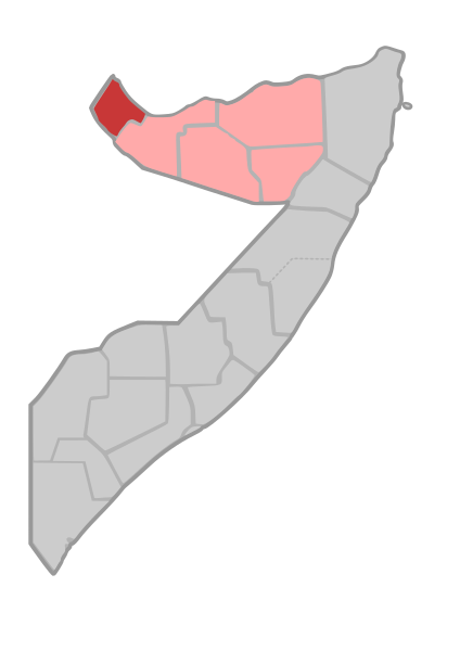
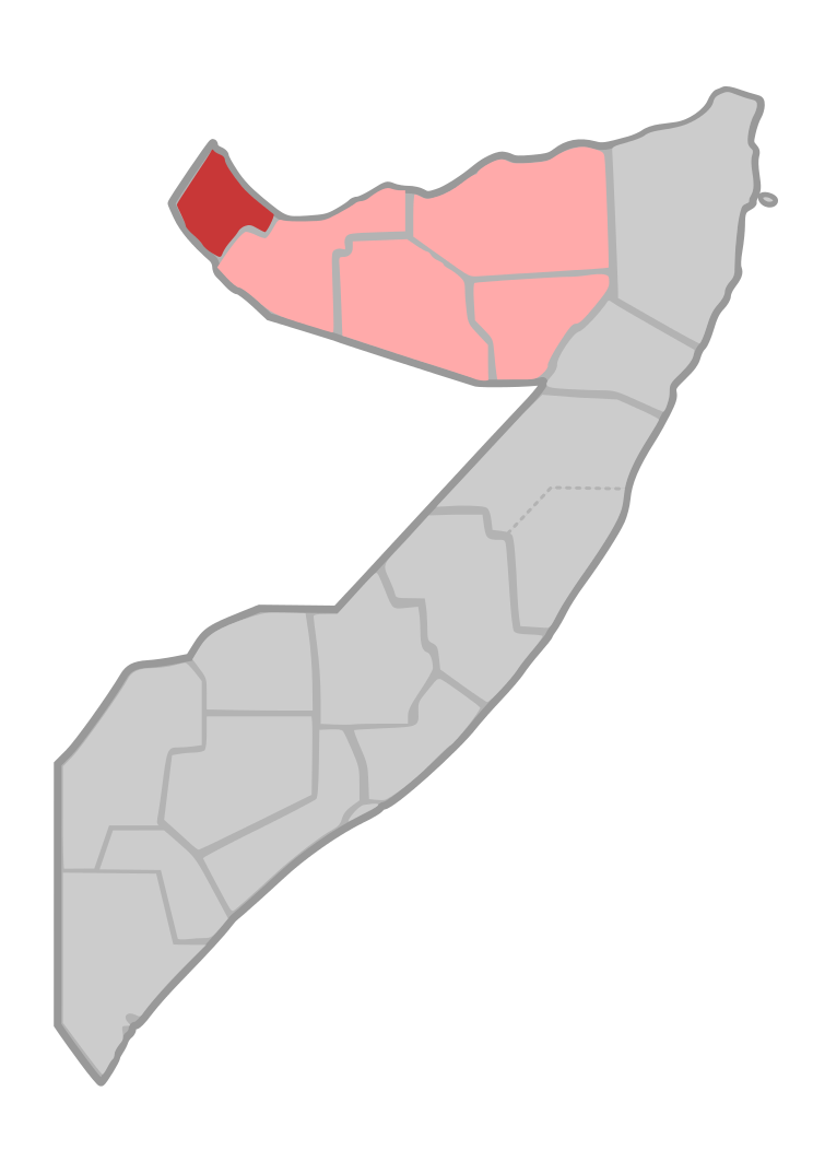
| Description | Map of Awdal Region of Somalia | ||
| Date | |||
| Source | own work, based on File:Somalia regions map.svg | ||
| Author | de:user:Sven-steffen arndt | ||
| Permission (Reusing this file) |
|
Matimu ya fayili
thlava eka siku/nkarhi leswaku u vona leswi fayili ayirixiswona hi knarhi walowo
| Siku/Nkarhi | Xifanisonyana | Mpimo | Mutirhisi | Nhlamulo | |
|---|---|---|---|---|---|
| Sweswinyana | 17:21, 8 Mhawuri 2007 | | 744 × 1,052 (29 KB) | Lencer | |
| 20:57, 21 Nhlangula 2006 |  | 744 × 1,052 (28 KB) | Sven-steffen arndt | bigger outer border | |
| 17:05, 30 Ndzhati 2006 |  | 744 × 1,052 (28 KB) | Sven-steffen arndt | {{Information |Description=Map of Awdal Region of Somalia |Source=own work, based on Image:Somalia regions map.svg |Date=30. September 2006 |Author=de:user:Sven-steffen arndt |Permission={{PD-self}} |other_versions= }} [[Category:Maps of Region |
Ntsengo wakutirhisiwa ka fiyili leyi
tluka leri rikhekela eka fayili leyi:
Global file usage
The following other wikis use this file:
- Usage on de.wikipedia.org
- Usage on eo.wikipedia.org
- Usage on ha.wikipedia.org
- Usage on ig.wikipedia.org
- Usage on ja.wikipedia.org
- Usage on ka.wikipedia.org
- Usage on no.wikipedia.org
- Usage on pl.wikipedia.org
- Usage on ru.wikipedia.org
- Usage on tr.wikipedia.org
- Usage on uk.wikipedia.org
- Usage on ur.wikipedia.org
- Usage on www.wikidata.org