
File:Nigeria Local Government Areas.png
Size of this preview: 800 × 527 pixels. Other resolutions: 320 × 211 pixels | 640 × 421 pixels | 1,024 × 674 pixels | 1,280 × 843 pixels | 1,601 × 1,054 pixels.
kuleha na ku anama hixitalo (1,601 × 1,054 ku anama na leha hi ti phikisele, Vukulu bya fayili: 71 KB, muxaka waMIME: image/png)
Birnin magaji
Nkomiso
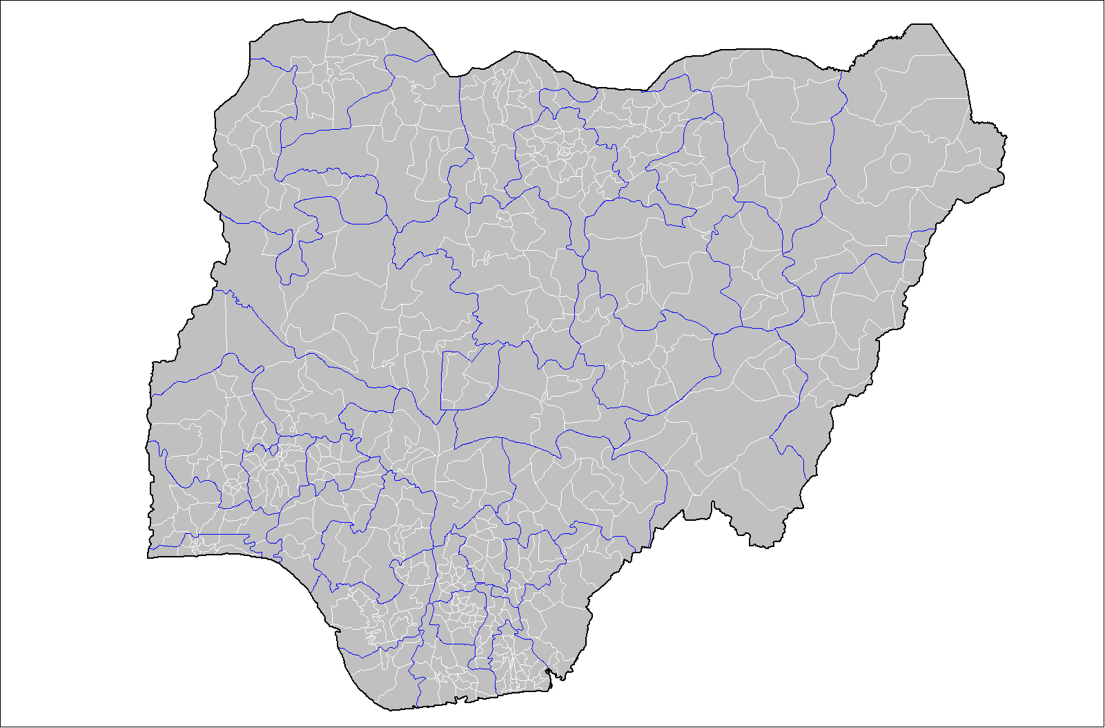
| Description | Map of the local government areas of Nigeria. Created by Rarelibra 15:42, 12 July 2007 (UTC) using MapInfo Professional v8.5 and various mapping resources. |
| Date | 12 Mawuwani 2007 (original upload date) |
| Source | No machine-readable source provided. Own work assumed (based on copyright claims). |
| Author | No machine-readable author provided. Rarelibra assumed (based on copyright claims). |
Nawu wo pfumelela
| This work has been released into the public domain by its author, I, Rarelibra. This applies worldwide. In some countries this may not be legally possible; if so: I, Rarelibra grants anyone the right to use this work for any purpose, without any conditions, unless such conditions are required by law. |
Matimu ya fayili
thlava eka siku/nkarhi leswaku u vona leswi fayili ayirixiswona hi knarhi walowo
| Siku/Nkarhi | Xifanisonyana | Mpimo | Mutirhisi | Nhlamulo | |
|---|---|---|---|---|---|
| Sweswinyana | 15:42, 12 Mawuwani 2007 | | 1,601 × 1,054 (71 KB) | Rarelibra | Map of the local government areas of Nigeria. Created by ~~~~ using MapInfo Professional v8.5 and various mapping resources. |
Ntsengo wakutirhisiwa ka fiyili leyi
Kuhava tluka leri khwekelaka eka fayili leyi
Global file usage
The following other wikis use this file:
- Usage on da.wikipedia.org
- Usage on de.wikipedia.org
- Usage on en.wikipedia.org
- Usage on es.wikipedia.org
- Usage on fr.wikipedia.org
- Usage on gl.wikipedia.org
- Usage on ha.wikipedia.org
- Usage on it.wikipedia.org
- Usage on kcg.wikipedia.org
- Usage on pt.wikipedia.org
- Usage on ru.wikipedia.org
- Usage on ur.wikipedia.org
- Usage on www.wikidata.org
- Usage on yo.wikipedia.org
- Usage on zh.wikipedia.org