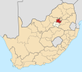
File:Map of South Africa with Tshwane highlighted (2011).svg
Appearance

Size of this PNG preview of this SVG file: 684 × 599 pixels. Other resolutions: 274 × 240 pixels | 548 × 480 pixels | 876 × 768 pixels | 1,168 × 1,024 pixels | 2,337 × 2,048 pixels | 809 × 709 pixels.
kuleha na ku anama hixitalo (Fayili ya SVG, vukulu lebyi ringaneke 809 × 709 hi ti phikisele, vukulu bya fayili: 467 KB)
Matimu ya fayili
thlava eka siku/nkarhi leswaku u vona leswi fayili ayirixiswona hi knarhi walowo
| Siku/Nkarhi | Xifanisonyana | Mpimo | Mutirhisi | Nhlamulo | |
|---|---|---|---|---|---|
| Sweswinyana | 20:19, 2 Mudyaxihi 2011 |  | 809 × 709 (467 KB) | Htonl | == Summary == {{Information |Description ={{en|1=Map of district boundaries in South Africa, as they will be after the municipal elections of 18 May 2011, with the [[w:City of Tshwane Metropolitan Municipali |
Ntsengo wakutirhisiwa ka fiyili leyi
tluka leri rikhekela eka fayili leyi:
Global file usage
The following other wikis use this file:
- Usage on af.wikipedia.org
- Pretoria
- Centurion
- Cullinan
- Marabastad
- Brooklyn, Pretoria
- Waterkloof
- Groenkloof
- Hatfield, Pretoria
- Arcadia, Pretoria
- Elarduspark
- Irene
- Bronkhorstspruit
- Valhalla
- Kleinfontein
- Mabopane
- Atteridgeville
- Capital Park
- Hammanskraal
- Rayton
- Die Wilgers
- Winterveld
- Rietfontein, Pretoria
- Highveld
- Erasmuskloof
- Wingate Park
- Pierre van Ryneveldpark
- Moreletapark
- Monument Park
- Waterkloofrif
- Menlopark, Pretoria
- Kloofsig
- Lyttelton
- Constantiapark
- Lynnwood
- Olievenhoutbosch
- Ga-Rankuwa
- Mamelodi
- Soshanguve
- Akasia
- Temba
- Chantelle
- Orchards, Pretoria
- Pretoria-Noord
- Rosslyn
- Laudium
- Lyttelton Manor
- Doringkloof
- Villieria
- Waverley
- Garsfontein
View more global usage of this file.

