
File:Gongola State Nigeria.jpg

Size of this preview: 676 × 600 pixels. Other resolutions: 271 × 240 pixels | 541 × 480 pixels | 866 × 768 pixels | 1,154 × 1,024 pixels | 1,869 × 1,658 pixels.
kuleha na ku anama hixitalo (1,869 × 1,658 ku anama na leha hi ti phikisele, Vukulu bya fayili: 197 KB, muxaka waMIME: image/jpeg)
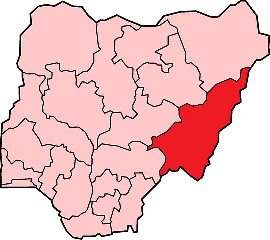
| Description | Map of the former Gongola State in Nigeria. Based on Nigerian states, 1976 - 1987, from data from United States Geological Survey, Africa Data Dissemination Service. |
| Date | (UTC) |
| Source | |
| Author |
|
I, the copyright holder of this work, hereby publish it under the following licenses:
| This file is licensed under the Creative Commons Attribution-Share Alike 3.0 Unported license. | ||
| ||
| This licensing tag was added to this file as part of the GFDL licensing update. |

|
Permission is granted to copy, distribute and/or modify this document under the terms of the GNU Free Documentation License, Version 1.2 or any later version published by the Free Software Foundation; with no Invariant Sections, no Front-Cover Texts, and no Back-Cover Texts. A copy of the license is included in the section entitled GNU Free Documentation License. |
You may select the license of your choice.
Original upload log
This image is a derivative work of the following images:
- File:Nigeria_states-1976-1987.png licensed with Cc-by-sa-3.0-migrated, GFDL
- 2010-04-21T21:23:40Z Bejnar 1869x1658 (95402 Bytes) {{Information |Description=Map of Nigerian states, 1976 - 1987, from data from United States Geological Survey, Africa Data Dissemination Service. |Source=*[[:File:Nigeria_states_1987-1991.png|]] |Date=2010-04-21 21:21 (UTC)
Uploaded with derivativeFX
Matimu ya fayili
thlava eka siku/nkarhi leswaku u vona leswi fayili ayirixiswona hi knarhi walowo
| Siku/Nkarhi | Xifanisonyana | Mpimo | Mutirhisi | Nhlamulo | |
|---|---|---|---|---|---|
| Sweswinyana | 09:10, 7 Hukuri 2010 | | 1,869 × 1,658 (197 KB) | Jssfrk | {{Information |Description=Map of the former Gongola State in Nigeria. Based on Nigerian states, 1976 - 1987, from data from United States Geological Survey, Africa Data Dissemination Service. |Source=*File:Nigeria_states-1976-1987.png |Date=2010-11 |
Ntsengo wakutirhisiwa ka fiyili leyi
tluka leri rikhekela eka fayili leyi:
Global file usage
The following other wikis use this file:
- Usage on ca.wikipedia.org
- Usage on en.wikipedia.org
- Usage on ha.wikipedia.org
- Usage on ig.wikipedia.org
- Usage on pt.wikipedia.org
- Usage on sv.wikipedia.org
- Usage on sw.wikipedia.org
- Usage on www.wikidata.org
- Usage on yo.wikipedia.org
- Usage on zu.wikipedia.org