
File:Georgia (orthographic projection).svg

Size of this PNG preview of this SVG file: 553 × 553 pixels. Other resolutions: 240 × 240 pixels | 480 × 480 pixels | 768 × 768 pixels | 1,024 × 1,024 pixels | 2,048 × 2,048 pixels.
kuleha na ku anama hixitalo (Fayili ya SVG, vukulu lebyi ringaneke 553 × 553 hi ti phikisele, vukulu bya fayili: 302 KB)
Nkomiso
| Description |
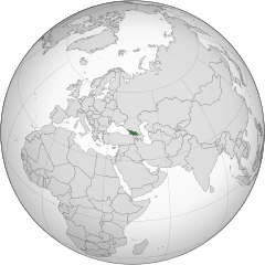
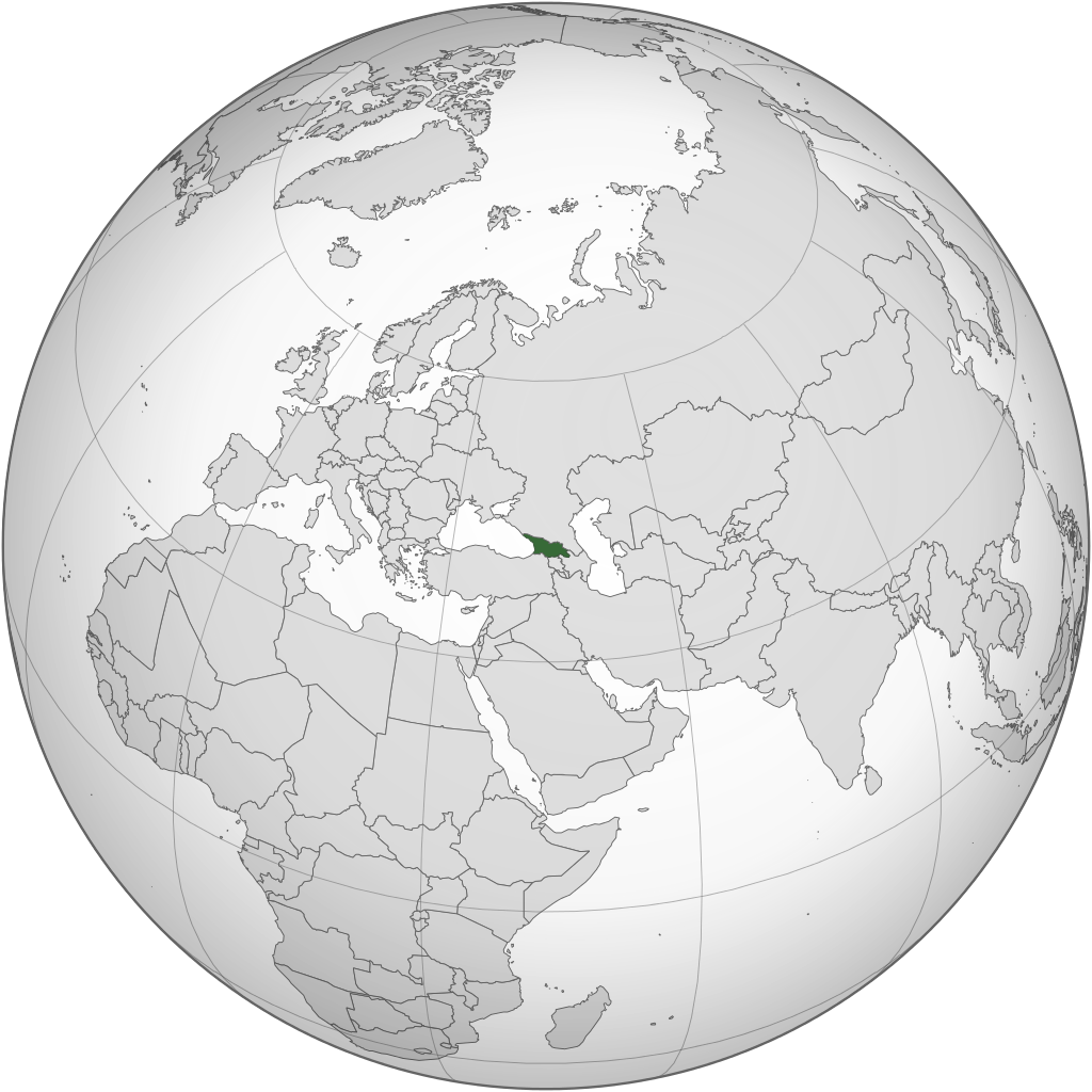
English: Location of Georgia.
.svg) |
| Date | |
| Source | Own work |
| Author | Izzedine |
| Other versions |
.svg) .svg) |
| SVG genesis |
.svg)
.svg)
.svg)
.svg)
.svg)
.svg)
.svg)
.svg)
.svg)
.svg)
.svg)
.svg)
.svg)
.svg)
.svg)
.svg)
.svg)
.svg)
.svg)
.svg)
.svg)
.svg)
.svg)
.svg)
.svg)
.svg)
.svg)
.svg)
.svg)
.svg)
.svg)
.svg)
.svg)
.svg)
.svg)
.svg)
.svg)
.svg)
.svg)
.svg)
.svg)
.svg)
.svg)
.svg)
.svg)
.svg)
.svg)
.svg)
.svg)
.svg)
.svg)
.svg)
.svg)
.svg)
.svg)
.svg)
.svg)
.svg)
.svg)
.svg)
.svg)
.svg)
.svg)
.svg)
.svg)
.svg)
.svg)
.svg)
.svg)
.svg)
.svg)
.svg)
.svg)

.svg)

.svg)

.svg)
.svg)
.svg)
.svg)
.svg)
.svg)
.svg)


.svg)
.svg)
.svg)
.svg)
.svg)
.svg)
.svg)

.svg)
.svg)
.svg)
.svg)
.svg)
.svg)
.svg)
.svg)
.svg)
.svg)

.svg)
.svg)
.svg)
.svg)
.svg)
.svg)
.svg)
_without_national_boundaries.svg)
.svg)
.svg)
.svg)
.svg)
.svg)
.svg)

.svg)
.svg)
.png)
.svg)
.svg)

.svg)
.svg)
.svg)
.svg)
.svg)
.svg)
.svg)
.svg)
.svg)
.svg)
.svg)

.svg)
.svg)
.svg)
.svg)
.svg)
.svg)
.svg)
.svg)
.svg)

.svg)
.svg)

.svg)
.svg)
.svg)
.svg)
.svg)
.svg)
.svg)
.svg)
.svg)
.svg)
.svg)
.svg)
.svg)
.svg)
.svg)
.svg)
.svg)
.svg)
.svg)
.svg)
.svg)
.svg)
.svg)
.svg)
.svg)
.svg)
.svg)
_-_Crimea_disputed.svg)
.svg)
.svg)
.svg)
.svg)
.svg)
.svg)
.svg)
.svg)
.svg)
.svg)
.svg)
_political.svg)
.svg)
.svg)
.svg)
.svg)
_-_Crimea_disputed_-_no_borders.svg)
.svg)
.svg)
.svg)
.svg)
.svg)
.svg)
.svg)
.svg)
.svg)
.svg)
.svg)

.svg)
.svg)
.svg)

.png)
.svg)
.svg)
.svg)
.svg)
.svg)
.svg)
.svg)
.svg)
.svg)
.svg)
.svg)
.svg)
.svg)
.svg)
.svg)
.svg)
.svg)
.svg)
.svg)
.svg)
.svg)
.svg)
.svg)
.svg)
.svg)
.svg)
.svg)
.svg)
.svg)
.svg)
.svg)
.svg)
.svg)
.svg)
.png)
.svg)
.svg)
.svg)
_(orthographic_projection).png)
.svg)
Nawu wo pfumelela
I, the copyright holder of this work, hereby publish it under the following license:
This file is licensed under the Creative Commons Attribution-Share Alike 3.0 Unported license.
- You are free:
- to share – to copy, distribute and transmit the work
- to remix – to adapt the work
- Under the following conditions:
- attribution – You must give appropriate credit, provide a link to the license, and indicate if changes were made. You may do so in any reasonable manner, but not in any way that suggests the licensor endorses you or your use.
- share alike – If you remix, transform, or build upon the material, you must distribute your contributions under the same or compatible license as the original.
Matimu ya fayili
thlava eka siku/nkarhi leswaku u vona leswi fayili ayirixiswona hi knarhi walowo
.svg&dir=prev)
.svg&offset=20110417101642)
.svg&offset=&limit=20)
.svg&offset=&limit=50)
.svg&offset=&limit=100)
.svg&offset=&limit=250)
.svg&offset=&limit=500)
| Siku/Nkarhi | Xifanisonyana | Mpimo | Mutirhisi | Nhlamulo | |
|---|---|---|---|---|---|
| Sweswinyana | 22:12, 18 Nyenyankulu 2015 | | 553 × 553 (302 KB) | Flappiefh | Added Western Sahara, fixed Somalia and removed Kosovo. |
| 12:19, 4 Mhawuri 2013 |  | 553 × 553 (307 KB) | Flappiefh | Added South Sudan. | |
| 21:37, 12 Ndzhati 2012 |  | 550 × 550 (437 KB) | Palosirkka | Scrubbed with http://codedread.com/scour/ | |
| 02:15, 13 Mudyaxihi 2011 |  | 550 × 550 (562 KB) | Geagea | Reverted to version as of 00:04, 8 January 2011. Original file. | |
| 22:27, 12 Mudyaxihi 2011 |  | 550 × 550 (773 KB) | Shibo77 | Reverted to version as of 05:49, 27 April 2011 sockpuppet | |
| 07:08, 3 Mudyaxihi 2011 |  | 550 × 550 (562 KB) | Pols~commonswiki | Avoid overwriting existing files | |
| 05:49, 27 Dzivamusoko 2011 |  | 550 × 550 (773 KB) | Shibo77 | Reverted to version as of 10:58, 17 April 2011 (reverting sockpuppet's reversion) | |
| 17:57, 17 Dzivamusoko 2011 |  | 550 × 550 (562 KB) | Sigismun | I have been yelled at that we are not allowed to rewrite existing maps. So why not create a separate file? | |
| 10:58, 17 Dzivamusoko 2011 |  | 550 × 550 (773 KB) | Night w | {{Information |Description ={{en|1=Locator map of Georgia}} |Source =Own work |Author =Night w |Date = |Permission = |other_versions = }} match up boxes, reduce lineage | |
| 10:16, 17 Dzivamusoko 2011 |  | 550 × 550 (782 KB) | Night w | try this? |
Ntsengo wakutirhisiwa ka fiyili leyi
Kuhava tluka leri khwekelaka eka fayili leyi
Global file usage
The following other wikis use this file:
- Usage on af.wikipedia.org
- Usage on avk.wikipedia.org
- Usage on az.wiktionary.org
- Usage on en.wikipedia.org
- Usage on es.wikipedia.org
- Usage on fi.wikipedia.org
- Usage on fr.wikinews.org
- Usage on gv.wikipedia.org
- Usage on pap.wikipedia.org
- Usage on pl.wiktionary.org
- Usage on ru.wikinews.org
- Usage on sa.wikipedia.org
- Usage on uk.wikipedia.org
- Usage on uk.wikinews.org
- Usage on zh-classical.wikipedia.org
- Usage on zh.wikipedia.org
.svg)