
File:Eritrea districts.png

Size of this preview: 800 × 548 pixels. Other resolutions: 320 × 219 pixels | 640 × 439 pixels | 1,024 × 702 pixels | 1,281 × 878 pixels.
kuleha na ku anama hixitalo (1,281 × 878 ku anama na leha hi ti phikisele, Vukulu bya fayili: 20 KB, muxaka waMIME: image/png)
Nkomiso
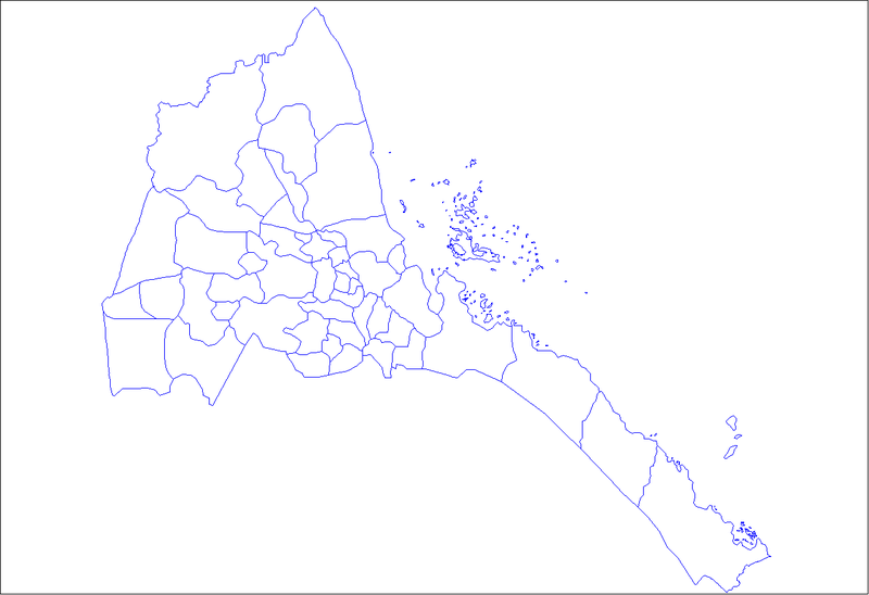
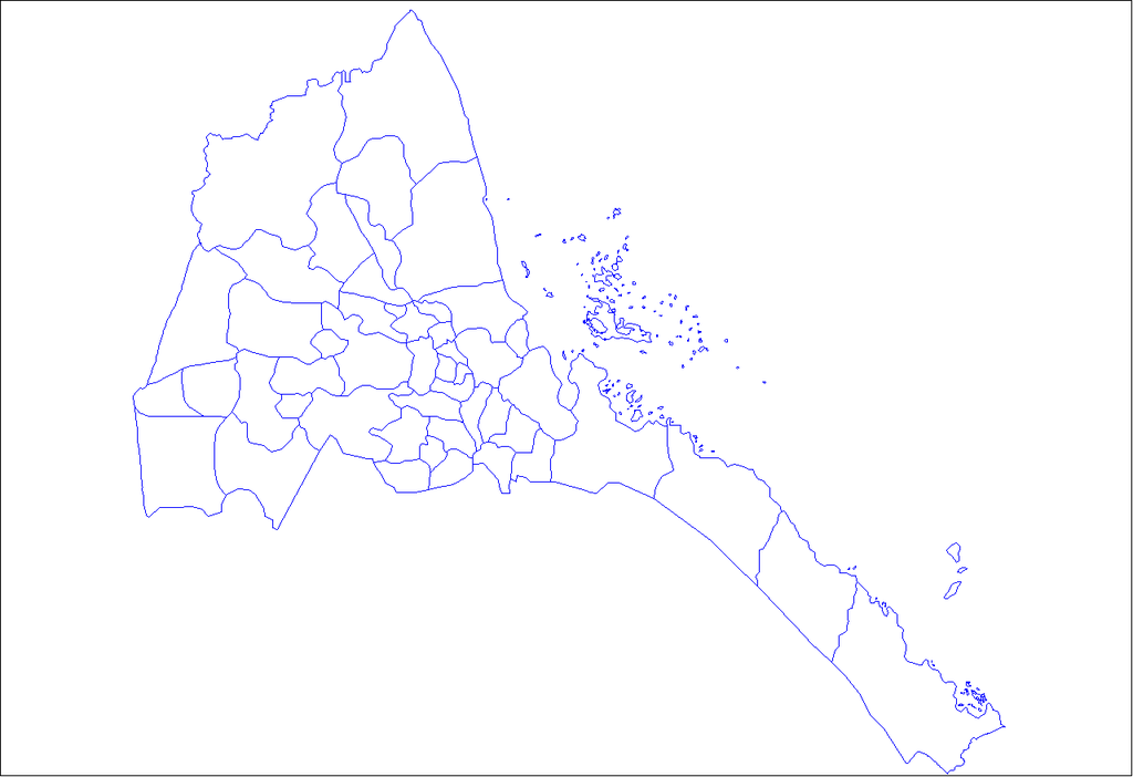
| Description | Map of the districts of Eritrea. Created by Rarelibra 19:03, 11 April 2007 (UTC) for public domain use, using MapInfo Professional v8.5 and various mapping resources. |
| Date | 11 Dzivamusoko 2007 (original upload date) |
| Source | No machine-readable source provided. Own work assumed (based on copyright claims). |
| Author | No machine-readable author provided. Rarelibra assumed (based on copyright claims). |
Nawu wo pfumelela
| I, the copyright holder of this work, release this work into the public domain. This applies worldwide. In some countries this may not be legally possible; if so: I grant anyone the right to use this work for any purpose, without any conditions, unless such conditions are required by law. |
Matimu ya fayili
thlava eka siku/nkarhi leswaku u vona leswi fayili ayirixiswona hi knarhi walowo
| Siku/Nkarhi | Xifanisonyana | Mpimo | Mutirhisi | Nhlamulo | |
|---|---|---|---|---|---|
| Sweswinyana | 19:03, 11 Dzivamusoko 2007 | | 1,281 × 878 (20 KB) | Rarelibra | Map of the districts of Eritrea. Created by ~~~~ for public domain use, using MapInfo Professional v8.5 and various mapping resources. |
Ntsengo wakutirhisiwa ka fiyili leyi
tluka leri rikhekela eka fayili leyi:
Global file usage
The following other wikis use this file:
- Usage on ar.wikipedia.org
- Usage on en.wikipedia.org
- Subregions of Eritrea
- User talk:Markussep/Archive 4
- Template:Districts of Eritrea
- Adi Tekelezan Subregion
- Asmat Subregion
- Elabered Subregion
- Geleb Subregion
- Hagaz Subregion
- Halhal Subregion
- Habero Subregion
- Keren Subregion
- Kerkebet Subregion
- Sela Subregion
- Berikh Subregion
- Ghala Nefhi Subregion
- North Eastern Subregion
- Serejaka Subregion
- South Eastern Subregion
- South Western Subregion
- Akurdet Subregion
- Dghe Subregion
- Gogne Subregion
- Barentu Subregion
- Forto Subregion
- Haykota Subregion
- Logo Anseba Subregion
- Mensura Subregion
- Mogolo Subregion
- Shambuko Subregion
- Molki Subregion
- Teseney Subregion
- Omhajer Subregion
- Upper Gash Subregion
- Afabet Subregion
- Dahlak Subregion
- Ghela'elo Subregion
- Foro Subregion
- Ghinda Subregion
- Karura Subregion
- Massawa Subregion
- She'eb Subregion
- Adi Keyh Subregion
- Adi Quala Subregion
- Areza Subregion
- Debarwa Subregion
- Dekemhare Subregion
- Kudo Be'ur Subregion
- Mai-Mne Subregion
- Mendefera Subregion
View more global usage of this file.