
File:Ash Tree - geograph.org.uk - 590710.jpg

Size of this preview: 450 × 600 pixels. Other resolutions: 180 × 240 pixels | 480 × 640 pixels.
kuleha na ku anama hixitalo (480 × 640 ku anama na leha hi ti phikisele, Vukulu bya fayili: 109 KB, muxaka waMIME: image/jpeg)
Nkomiso
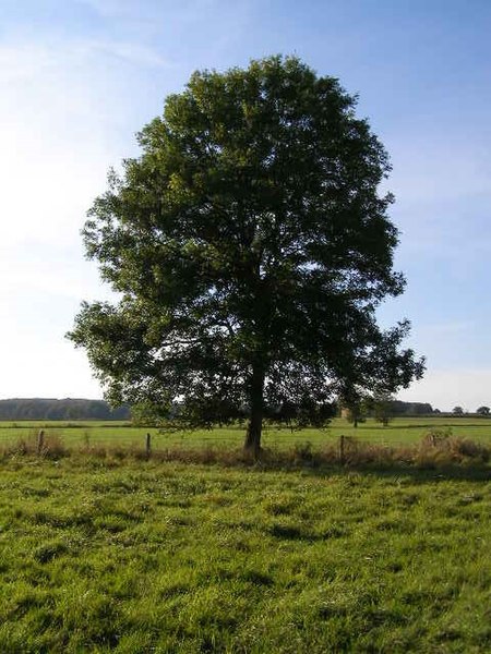
| Description |
English: Ash Tree This rather isolated ash tree has lost few leaves this autumn and presents a formidable barrier to strong winds. |
| Date | |
| Source | From geograph.org.uk |
| Author | Brian Green |
| Attribution (required by the license) | Brian Green / Ash Tree / |
| Camera location | | View this and other nearby images on: OpenStreetMap |
|---|
_heading:270.00&language=ts)
| Object location | | View this and other nearby images on: OpenStreetMap |
|---|
_heading:270.00&language=ts)
Nawu wo pfumelela

|
This image was taken from the Geograph project collection. See this photograph's page on the Geograph website for the photographer's contact details. The copyright on this image is owned by Brian Green and is licensed for reuse under the Creative Commons Attribution-ShareAlike 2.0 license.
|
This file is licensed under the Creative Commons Attribution-Share Alike 2.0 Generic license.
Attribution: Brian Green
- You are free:
- to share – to copy, distribute and transmit the work
- to remix – to adapt the work
- Under the following conditions:
- attribution – You must give appropriate credit, provide a link to the license, and indicate if changes were made. You may do so in any reasonable manner, but not in any way that suggests the licensor endorses you or your use.
- share alike – If you remix, transform, or build upon the material, you must distribute your contributions under the same or compatible license as the original.
Matimu ya fayili
thlava eka siku/nkarhi leswaku u vona leswi fayili ayirixiswona hi knarhi walowo
| Siku/Nkarhi | Xifanisonyana | Mpimo | Mutirhisi | Nhlamulo | |
|---|---|---|---|---|---|
| Sweswinyana | 08:34, 15 Nyenyenyani 2019 | | 480 × 640 (109 KB) | Radiotrefoil | Original JPG has a malformed header, causing very strange rendering glitches to appear. |
| 17:00, 6 Nyenyenyani 2011 |  | 480 × 640 (51 KB) | GeographBot | == {{int:filedesc}} == {{Information |description={{en|1=Ash Tree This rather isolated ash tree has lost few leaves this autumn and presents a formidable barrier to strong winds.}} |date=2007-10-21 |source=From [http://www.geograph.org.uk/photo/590710 geo |
Ntsengo wakutirhisiwa ka fiyili leyi
tluka leri rikhekela eka fayili leyi:
Global file usage
The following other wikis use this file:
- Usage on ar.wikipedia.org
- Usage on as.wikipedia.org
- Usage on awa.wikipedia.org
- Usage on azb.wikipedia.org
- Usage on az.wikipedia.org
- Usage on bcl.wiktionary.org
- Usage on bh.wikipedia.org
- Usage on cs.wikipedia.org
- Usage on da.wikipedia.org
- Usage on en.wikipedia.org
- Usage on en.wiktionary.org
- Usage on eo.wikipedia.org
- Usage on es.wikipedia.org
- Usage on fi.wikipedia.org
- Usage on he.wikipedia.org
- Usage on hi.wiktionary.org
- Usage on hy.wikiquote.org
- Usage on id.wikipedia.org
- Usage on id.wiktionary.org
- Usage on ie.wikipedia.org
- Usage on incubator.wikimedia.org
- Usage on kn.wikipedia.org
- Usage on min.wikipedia.org
- Usage on mni.wikipedia.org
- Usage on om.wikipedia.org
- Usage on ru.wikipedia.org
- Usage on ru.wiktionary.org
- Usage on rw.wikipedia.org
- Usage on simple.wikipedia.org
- Usage on si.wikipedia.org
- Usage on so.wikipedia.org
View more global usage of this file.