
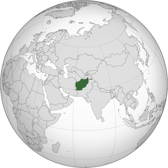
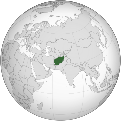
File:Afghanistan (orthographic projection).svg

Size of this PNG preview of this SVG file: 553 × 553 pixels. Other resolutions: 240 × 240 pixels | 480 × 480 pixels | 768 × 768 pixels | 1,024 × 1,024 pixels | 2,048 × 2,048 pixels.
kuleha na ku anama hixitalo (Fayili ya SVG, vukulu lebyi ringaneke 553 × 553 hi ti phikisele, vukulu bya fayili: 298 KB)
.svg)
Nkomiso
| Description |
اردو: طرحی متعامد از افغانستان |
| Date | |
| Source | Own work based on: India (orthographic projection).svg by Ssolbergj |
| Author | Shahid Parvez |
| SVG genesis |
.svg)
Nawu wo pfumelela
The map has been created with the Generic Mapping Tools: https://www.generic-mapping-tools.org/ using one or more of these public-domain datasets for the relief:
|

|
Permission is granted to copy, distribute and/or modify this document under the terms of the GNU Free Documentation License, Version 1.2 or any later version published by the Free Software Foundation; with no Invariant Sections, no Front-Cover Texts, and no Back-Cover Texts. A copy of the license is included in the section entitled GNU Free Documentation License. |
Original upload log
Transferred from en.wikipedia to Commons by Cirt using CommonsHelper.
The original description page was here. All following user names refer to en.wikipedia.
- 2009-10-05 17:28 Parvez gsm 541×541× (517730 bytes) {{Information |Description = Afghanistan orthographic_projection |Source = I have created this work entirely by myself. |Date = October 5 |Author = Shahid Parvez |other_versions = }}
Matimu ya fayili
thlava eka siku/nkarhi leswaku u vona leswi fayili ayirixiswona hi knarhi walowo
| Siku/Nkarhi | Xifanisonyana | Mpimo | Mutirhisi | Nhlamulo | |
|---|---|---|---|---|---|
| Sweswinyana | 14:46, 27 Mawuwani 2019 | | 553 × 553 (298 KB) | Cerebellum | Revert to prior version, please provide a source for those territorial claims |
| 10:29, 26 Mawuwani 2019 |  | 720 × 720 (384 KB) | Lakshmisreekanth | Updated color | |
| 17:00, 25 Mawuwani 2019 |  | 720 × 727 (397 KB) | Lakshmisreekanth | Added claimed regions | |
| 23:36, 16 Nyenyankulu 2015 |  | 553 × 553 (298 KB) | Flappiefh | Removed Somaliland and Kosovo. Separated Western Sahara and Morroco. | |
| 12:43, 4 Mhawuri 2013 |  | 553 × 553 (302 KB) | Flappiefh | Added South Sudan. The map is now centered on Afghanistan. | |
| 22:45, 20 Hukuri 2009 |  | 541 × 541 (506 KB) | File Upload Bot (Magnus Manske) | {{BotMoveToCommons|en.wikipedia|year={{subst:CURRENTYEAR}}|month={{subst:CURRENTMONTHNAME}}|day={{subst:CURRENTDAY}}}} {{Information |Description={{en|Afghanistan orthographic_projection}} |Source=Transferred from [http://en.wikipedia.org en.wikipedia]; |
Ntsengo wakutirhisiwa ka fiyili leyi
tluka leri rikhekela eka fayili leyi:
Global file usage
The following other wikis use this file:
- Usage on ady.wikipedia.org
- Usage on af.wikipedia.org
- Usage on ami.wikipedia.org
- Usage on arc.wikipedia.org
- Usage on ar.wikipedia.org
- Usage on arz.wikipedia.org
- Usage on ast.wikipedia.org
- Usage on as.wikipedia.org
- Usage on av.wikipedia.org
- Usage on awa.wikipedia.org
- Usage on azb.wikipedia.org
- Usage on az.wikipedia.org
- Usage on az.wiktionary.org
- Usage on ba.wikipedia.org
- Usage on bbc.wikipedia.org
- Usage on be-tarask.wikipedia.org
- Usage on be.wikipedia.org
- Usage on bg.wikipedia.org
- Usage on bh.wikipedia.org
- Usage on bi.wikipedia.org
- Usage on bn.wikipedia.org
- Usage on bn.wikivoyage.org
- Usage on br.wikipedia.org
View more global usage of this file.
.svg)
.svg)