
File:Sulphur Tornado Radar Image.png
Size of this preview: 800 × 394 pixels. Other resolutions: 320 × 158 pixels | 640 × 315 pixels | 1,024 × 505 pixels | 1,280 × 631 pixels | 2,322 × 1,144 pixels.
kuleha na ku anama hixitalo (2,322 × 1,144 ku anama na leha hi ti phikisele, Vukulu bya fayili: 5.03 MB, muxaka waMIME: image/png)
Nkomiso
| Description |
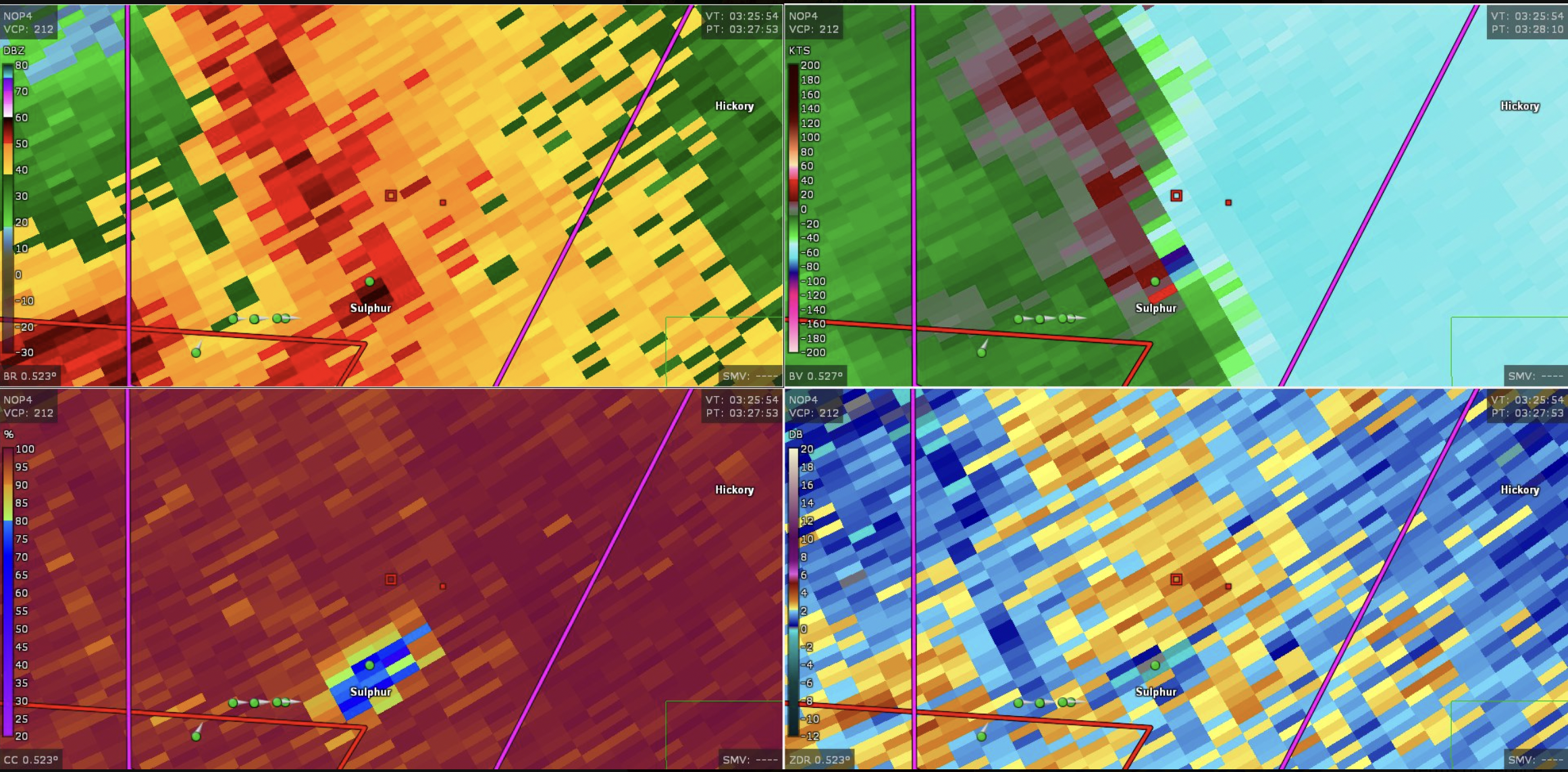
English: This image shows the radar presentation of a damaging tornado in Sulphu,r Oklahoma on April 27, 2024. |
| Date | |
| Source | NEXRAD |
| Author | National Weather Service, Federal Aviation Administration, United States Air Force |
Nawu wo pfumelela
This image is in the public domain because it is from one or more of the U.S. government’s 159 NEXRAD radars, which are jointly owned and operated by the National Weather Service (NWS), an agency of the National Oceanic and Atmospheric Administration (NOAA) within the United States Department of Commerce, the Federal Aviation Administration (FAA) within the Department of Transportation, and the U.S. Air Force within the Department of Defense.
Thus all NEXRAD images are public domain.
|
  |
Matimu ya fayili
thlava eka siku/nkarhi leswaku u vona leswi fayili ayirixiswona hi knarhi walowo
| Siku/Nkarhi | Xifanisonyana | Mpimo | Mutirhisi | Nhlamulo | |
|---|---|---|---|---|---|
| Sweswinyana | 19:44, 28 Dzivamusoko 2024 | | 2,322 × 1,144 (5.03 MB) | Floriangkmcc | Uploaded a work by The National Weather Service from Nexrad Radar with UploadWizard |
Ntsengo wakutirhisiwa ka fiyili leyi
Kuhava tluka leri khwekelaka eka fayili leyi